AUCTION: March 23rd 6PM
359+/- located in West Tulsa County 1 mile east of Coyote Trail and 41st St intersection, Coyote Trail Ranch is nestled in a beautiful and growing area ideal for residential development, private estates, recreational and investment buyers. Offered in 10 parcels ranging from 20ac to 72ac the land is mostly timbered with bluffs and draws running throughout, several ponds and Fisher Creek running throughout property. 9 of the 10 parcels have paved road frontage along with access to city water. Interior roads have been roughed-in for convenient viewing of property. Coyote Trail Ranch Auction offers the opportunity to purchase quiet country living surrounded by nature with the conveniences of Tulsa a few short minutes away.
Directions: 4 mi W of Hwy 97 & 41st St
Auction Overview
AUCTION DATE & TIME:
Thu, March 23rd 6PM
AUCTION LOCATION:
Discoveryland
19501 W 41st, Sand Springs
OPEN HOUSE / INSPECTIONS:
View at your convenience during daylight hours (ATV’s & UTV’s Welcome – Call office for access)
BUYER-BROKER:
3% compensation

Property will be sold in 10 parcels, ranging from 18+/-ac to 66+/-ac. Land has a diverse terrain with a vast amount of woods, wet weather creek, cliffs and plateaus with picturesque views.
LICENSE INFO: OK RE Lic# 159708 Ronn Cunningham | Cunningham Johnson Auctions LLC
359+/- acres of scenic ranch selling in 10 parcels. This upscale area with panoramic views of rolling terrain offer ideal building sites for ranchettes, country estates or recreational use.
Parcels 1-5
Paved road frontage from W 41st St. borders the northern side of each of these parcels making them ideal for home sites within minutes from the QT in Prattville. Diverse terrain of rolling hills and ridges make excellent vistas for your home or excellent terrain for hiking, riding ATV/UTV’s, or hiding wildlife. A meandering wet weather creek traverses the bottom of the ridges creating a truly unique landscape.
Parcels 7-9
Hardwoods scatter the landscape with a sloping topographical terrain towards the north. Flat building sites are located on the southern edge of each of these parcels fronting the paved road of Coyote Trail.
Parcels 6,10
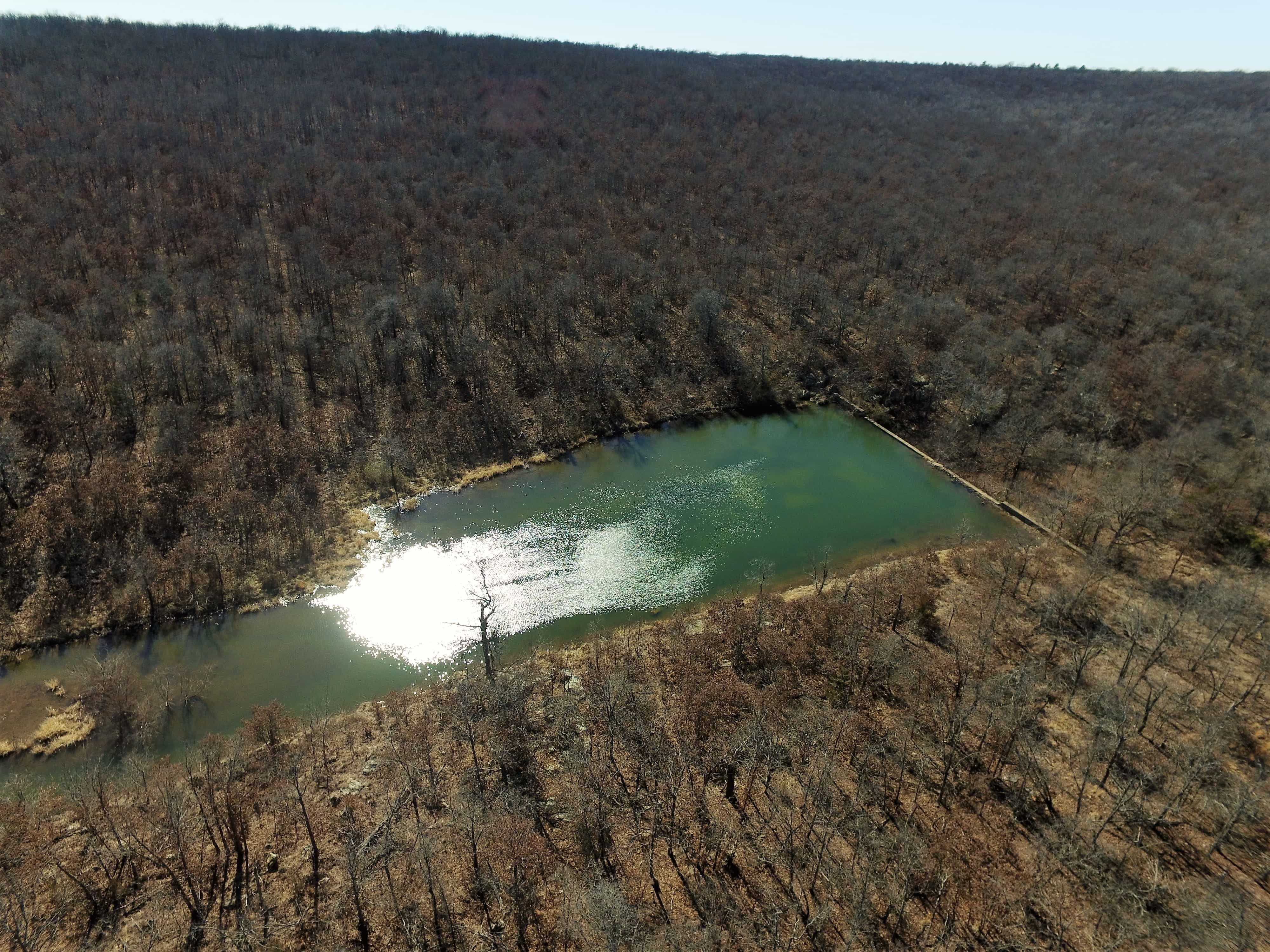
Parcel 6 is accessed from W 46th St S on the eastern side with parcel 10 being accessed from 50’ easement. A wet weather creek wonders through the land and stocked pond measuring just under 1ac with concrete spillway give these parcels a unique secluded feel although backing up to a subdivision and quick access to town.
Parcel 1: 35.23+/-ac
Parcel 2: 35.16+/-ac
Parcel 3: 72.31+/-ac
Parcel 4: 32.21+/-ac
Parcel 5: 22.96+/-ac
Parcel 6: 52.01+/-ac
Parcel 7: 20.34+/-ac
Parcel 8: 21.87+/-ac
Parcel 9: 27.32+/-ac
Parcel 10: 40.00+/-ac
SCHOOLS:
- Sand Springs School District
UTILITIES:
- Water: City of Sand Springs
- Electric: Indian Electric Cooperative
- Sewer: Septic
All map & boundary illustrations are approximate – please refer to survey.
Property pictures & video represent identified parcel(s) however, pictures & video may show multiple parcels and/or property not included in the auction.
Property Video
Aerial Boundary Photos
Aerial Photos
Photos
All map & boundary illustrations are approximate – refer to survey.
USDA Soil Maps
[media-downloader media_id=”2152″ image_url=”https://cj-auctions.com/wp-content/uploads/2015/08/Unknown.png”]
[media-downloader media_id=”2152″ texts=”Download”]
Soil Map
DISCLOSURES:
· All parcels subject to any existing recorded easements.
· Buyer responsible for $600 per parcel survey fee.
· Locations of parcel signs, maps, and picture illustrations are for reference only. Refer to survey for boundaries if available and/or legal descriptions. Fence lines may not follow property boundaries per survey.
· If property divides, all abstracts covering any individual parcel will be placed on deposit with said title company to be held for the use of any and all future buyers. Buyers are responsible for the cost of supplemental abstract(s).
· A 50’ easement favors parcels 8,9, & 10. Parcel 10 will require a building permit variance from Tulsa County Board of Adjustment if desired.
· Portions of parcels 3, 4, 5, 6 may lie within a flood zone. See FEMA map on website under ‘Maps’.
· No minerals convey
Terms & Conditions:
3% Buyer’s Premium applies to this sale. Buyers-premium is an additional fee (3% of high-bid amount) paid by the high-bidder.
All properties are being sold ‘as is, where is’ and are not subject to financing, inspections or any other contingencies.
CJ Auctions represents the seller only.
The high bidder must make a 10% (Min $5,000) non-refundable deposit on sale day (cash, personal or cashier checks).
Buyer will receive deed and title insurance.
Buyer will pay for (but not limited to) the survey, closing fee, title policy. Taxes will be prorated through date of closing.
Balance and closing costs are due 30 days from seller acceptance.
Sale is subject to seller confirmation.
All bidders must register with CJ Auctions prior to bidding (registration is held 1-hour prior to auction) and provide a driver’s license or government-issued identification.
Absentee bidders must pre-register and qualify through CJ Auctions 48 hours prior to sale day.
All persons inspecting the property, attending an open house or auction do so at their own risk and shall not hold CJ Auctions or their agents liable for damages to their person or property.
ONLINE BIDDING: Individuals must wire 10% of opening bid amount (minimum $10,000) 48 hours prior to auction to be fully authorized to bid online. Contact CJ Auctions at 918 550 8118 for detailed wiring instructions. (Note: If property is selling by the acre then opening bid is multiplied by the total acreage)
LICENSE INFO: OK RE Lic# 159708 Ronn Cunningham | Cunningham Johnson Auctions LLC
Method of Sale: ‘buyers choice’ by the acre (High Bid multiplied by amount of acres in each parcel chosen)
• Buyer’s choice may be offered when more than one property/parcel is being auctioned
• Successful high bidder wins the right to choose a property/parcel or properties/parcels from a grouping of similar or like-kind
properties
• After high bidder selection, the property is deleted from the group and the bidding commences again
• Process continues until all properties/parcels are selected